Documented inputs
Record where information came from, the period it describes, and the date it was reviewed.
 LandmAIn
LandMain Platform
Draw a search area, investigate individual sites, compare infrastructure, and review terrain in a connected land intelligence workflow.
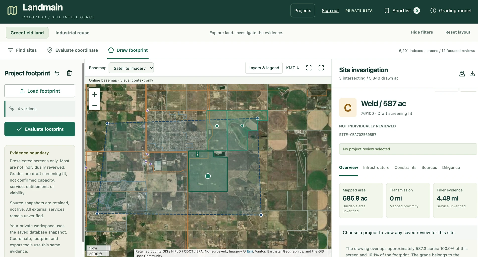
LandMain brings satellite imagery, site boundaries, infrastructure layers, and property measurements into a shared view. Move from a regional search to an individual site while keeping your research connected.
Request a platform walkthrough ↗Inside the LandMain platform
Compare sites within your search boundary using acreage, infrastructure distances, and mapped context. Open a candidate to investigate its characteristics and organize the next stage of research.
See the platform with your team ↗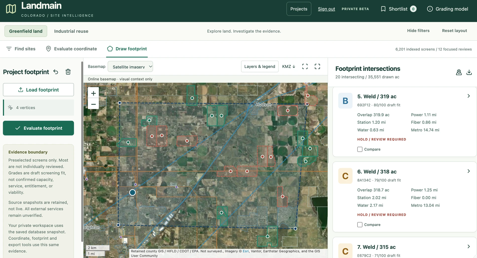
Inside the LandMain platform
Review mean slope, elevation range, slope distribution, and connected low-slope areas alongside the property map. Use the analysis to guide layout discussions and compare candidate sites.
See the platform with your team ↗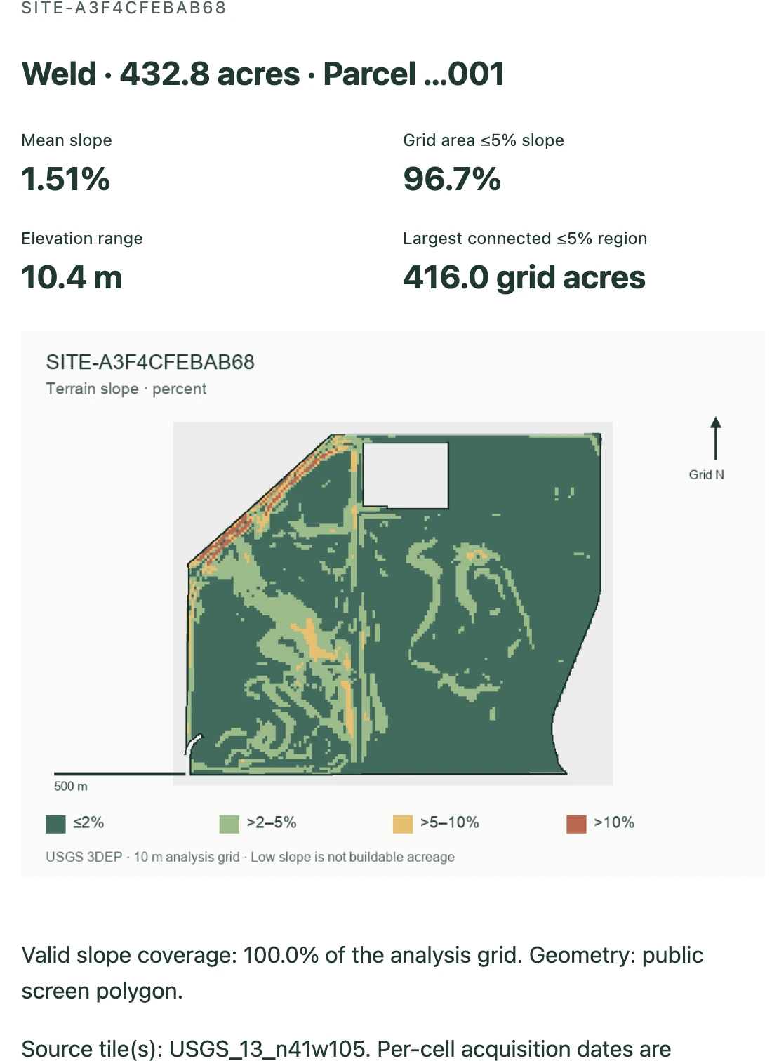
From search to a reviewable brief
Work from a consistent set of requirements and retain the evidence behind each finding.
AI-powered land analysis
Combine AI-assisted research and spatial analysis with a reviewable record of sources, measurements, and development findings.
Record where information came from, the period it describes, and the date it was reviewed.
Compare mapped signals, supporting records, and follow-up questions in a consistent format.
Identify the provider response, document, or specialist assessment needed next.